Explore the benefits of using GPS on a boat, such as and increased safety. Learn about different types of GPS systems, considerations when choosing one, installation tips, and how to utilize GPS for marine navigation.
Benefits of Using GPS on a Boat
GPS (Global Positioning System) technology has revolutionized navigation for boaters, offering a range of benefits that enhance the overall boating experience. From accurate navigation to increased safety and efficient route planning, GPS systems have become an essential tool for any boat owner. Let’s explore these benefits in more detail.
Accurate Navigation
One of the primary advantages of using GPS on a boat is the ability to achieve accurate navigation. With GPS, boaters can determine their precise position on the water, ensuring they stay on course and reach their destination with ease. Gone are the days of relying solely on visual landmarks or traditional navigation methods that may be prone to error. GPS provides real-time positioning data, allowing boaters to navigate confidently, even in unfamiliar waters.
Increased Safety
Safety is a top priority for any boater, and GPS systems play a crucial role in enhancing safety on the water. By providing accurate and up-to-date information about vessel location, GPS helps boaters avoid hazardous areas, such as shallow waters or submerged obstacles. GPS also enables boaters to navigate around dangerous weather conditions or potential hazards, ensuring a safer voyage. In the event of an emergency, GPS can provide precise coordinates for search and rescue operations, facilitating a quicker response time.
Efficient Route Planning
Efficient route planning is another significant benefit of using GPS on a boat. With GPS, boaters can easily map out their desired route, taking into account factors such as distance, weather conditions, and specific waypoints. By optimizing the route, boaters can save time, fuel, and effort, making their journey more enjoyable and cost-effective. GPS also allows for the creation of customized routes, enabling boaters to explore new areas or plan scenic detours along the way.
In summary, the benefits of using GPS on a boat are manifold. Accurate navigation ensures boaters can confidently navigate even in unfamiliar waters. Increased safety is achieved through real-time positioning data and the ability to avoid potential hazards. Efficient route planning saves time, fuel, and effort, making the boating experience more enjoyable and cost-effective.
Now that we have discussed the benefits of using GPS on a boat, let’s delve into the different types of GPS systems available.
Types of GPS Systems for Boats
When it comes to GPS systems for boats, there are several options to choose from, each catering to different needs and preferences. Let’s explore three common types of GPS systems: Chartplotter GPS systems, handheld GPS devices, and fishfinder GPS combos.
Chartplotter GPS Systems
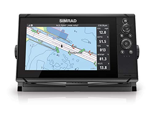
Chartplotter GPS systems are comprehensive navigation tools that combine GPS technology with electronic charting capabilities. These systems typically feature large, high-resolution screens that display detailed nautical charts, allowing boaters to visualize their position and surroundings. Chartplotter GPS systems offer a wide range of features, including waypoint marking, route planning, and even radar integration. They are particularly popular among boaters who require advanced navigation capabilities, such as sailors and offshore anglers.
Handheld GPS Devices
Handheld GPS devices are compact, portable units that offer basic navigation functionalities. These devices are perfect for boaters who require a simple and affordable GPS solution. Handheld GPS devices typically come with smaller screens and fewer features compared to chartplotter systems. However, they still provide accurate positioning data and basic navigation functions, such as waypoint marking and route tracking. Handheld GPS devices are popular among kayakers, canoeists, and boaters who engage in recreational activities on smaller bodies of water.

Fishfinder GPS Combos
Fishfinder GPS combos, as the name suggests, are GPS systems that integrate fishfinding capabilities with navigation functionalities. These systems are specifically designed for anglers who want to combine their fishing endeavors with efficient navigation. Fishfinder GPS combos offer features such as sonar technology, which allows boaters to locate fish and underwater structures. They also provide detailed nautical charts and navigation tools to ensure boaters can reach their favorite fishing spots with ease. Fishfinder GPS combos are widely used by both recreational and professional anglers.
Now that we have explored the different types of GPS systems, let’s move on to the considerations one should keep in mind when choosing a GPS for their boat.
Types of GPS Systems for Boats
When it comes to equipping your boat with a GPS system, there are a few different options to consider. Each type of GPS system offers unique features and benefits, catering to different boating needs. Let’s explore the three main types of GPS systems for boats: chartplotter GPS systems, handheld GPS devices, and fishfinder GPS combos.
Chartplotter GPS Systems
Chartplotter GPS systems are a popular choice among boaters looking for a comprehensive navigation solution. These systems combine GPS technology with detailed electronic charts, allowing you to view your boat’s position, track your route, and plan your journey with precision. With a chartplotter GPS system, you can easily navigate through unfamiliar waters, avoiding hazards and shallow areas.
One of the key advantages of a chartplotter GPS system is its large display screen. This makes it easy to view and interpret the electronic charts, even in bright sunlight or rough sea conditions. Some chartplotters also offer touchscreen functionality, providing a user-friendly interface for seamless navigation.

Chartplotter GPS systems can be further enhanced with additional features such as radar integration, AIS (Automatic Identification System) compatibility, and sonar capabilities. These advanced features enable boaters to have a comprehensive view of their surroundings, enhancing safety and situational awareness on the water.
Handheld GPS Devices
For boaters who prefer a portable and versatile GPS solution, handheld GPS devices are an excellent choice. These compact devices offer the convenience of being able to take your GPS system with you wherever you go, whether you’re on a small boat, kayak, or even hiking on land.
Handheld GPS devices typically have a smaller screen compared to chartplotters, but they still provide accurate navigation information. They often come preloaded with marine charts or can be connected to a computer to download additional mapping data.
One of the key advantages of handheld GPS devices is their durability and ruggedness. They are designed to withstand the rigors of outdoor use, including exposure to water, shocks, and vibrations. Many models are also equipped with features like a built-in compass, barometer, and altimeter, which can be useful for outdoor adventures beyond boating.
Fishfinder GPS Combos
If you’re an avid angler, a fishfinder GPS combo is a must-have tool for your boat. These systems combine the functionality of a GPS with advanced fishfinding technology, allowing you to locate fish and underwater structures with precision.

Fishfinder GPS combos utilize sonar technology to create detailed images of the underwater environment. They can display information about the depth of the water, the presence of fish, and the composition of the bottom surface. Some models even offer side-scanning and down-scanning capabilities, providing a more comprehensive view of the underwater world.
In addition to fishfinding features, these GPS systems also offer navigation functionalities, similar to chartplotters. They allow you to mark waypoints, create routes, and navigate to specific locations on the water. This makes them an excellent choice for anglers who want to combine navigation and fishing capabilities into one device.
To summarize, there are three main types of GPS systems for boats: chartplotter GPS systems, handheld GPS devices, and fishfinder GPS combos. Chartplotters provide comprehensive navigation solutions with large display screens and advanced features. Handheld GPS devices offer portability and versatility, making them ideal for boaters on the move. Fishfinder GPS combos combine fishfinding technology with GPS navigation, catering to anglers who want to locate fish while exploring the waters. Choose the type that best suits your boating needs and enjoy the benefits of accurate navigation, increased safety, and efficient route planning on your next boating adventure.
Considerations When Choosing a GPS for a Boat
When it comes to choosing a GPS for your boat, there are several important factors to consider. By taking the time to evaluate these considerations, you can ensure that you select a GPS system that meets your specific needs and enhances your boating experience. Let’s take a closer look at three key considerations: waterproof and shockproof design, user-friendly interface, and compatibility with marine charts.
Waterproof and Shockproof Design
One of the most critical considerations when choosing a GPS for your boat is its ability to withstand the harsh marine environment. Your GPS will be exposed to water, salt, and constant vibrations, so it’s crucial to select a device that is waterproof and shockproof.

A GPS with a waterproof design will be able to withstand splashes, rain, and even accidental submersion in water. This is essential for boaters who often find themselves in wet conditions or who enjoy water sports. Additionally, a shockproof GPS will be able to withstand the vibrations and impacts that come with navigating rough waters or encountering waves. This durability ensures that your GPS will continue to function optimally even in challenging conditions.
User-Friendly Interface
Another important consideration when choosing a GPS for your boat is the user-friendliness of its interface. Since you’ll be relying on your GPS for navigation, it’s crucial that you can easily understand and operate the device without any confusion or frustration.
Look for a GPS with a clear and intuitive interface that allows for easy navigation through menus and settings. A touchscreen display can be particularly user-friendly, as it allows for quick and precise input. Additionally, consider the size of the display and the font size of the text. A larger display and easily readable text ensure that you can view the information on your GPS without strain or difficulty, even in bright sunlight.
Compatibility with Marine Charts
The third consideration when choosing a GPS for your boat is its compatibility with marine charts. Marine charts provide detailed information about water depths, navigation aids, and potential hazards, making them essential for safe boating. Therefore, it’s crucial to ensure that your GPS is compatible with the marine charts you plan to use.
Many GPS systems are designed to work with specific chart types, such as Navionics or C-MAP. Before purchasing a GPS, check if it supports the chart format you prefer or if it allows for the installation of additional charts. Some GPS devices even offer the ability to download and update charts directly from the manufacturer’s website. This ensures that you always have access to the most up-to-date charts, giving you peace of mind as you navigate unfamiliar waters.
Installing a GPS on a Boat
When it comes to installing a GPS on your boat, there are a few important factors to consider. In this section, we will discuss the various aspects of installing a GPS system, including mounting options, power source and wiring, and positioning for optimal signal reception.
Mounting Options
Choosing the right mounting option for your boat’s GPS system is crucial for ensuring its stability and functionality. There are several options available, depending on the type of boat and personal preferences.
- Dashboard Mount: This is a popular option for smaller boats or those with limited space. A dashboard mount allows for easy access and visibility of the GPS display. It is typically installed using suction cups or adhesive pads.
- Flush Mount: This option provides a clean and streamlined look by integrating the GPS system into the boat’s console. It requires cutting a hole in the dashboard and securing the unit in place with mounting brackets. Flush mounts are commonly used in larger boats or those with dedicated electronics panels.
- Bracket Mount: A bracket mount offers flexibility in terms of positioning and adjustability. It involves attaching a bracket to the boat’s console or railing and then securing the GPS system onto it. This option is suitable for boats with irregular surfaces or where a flush mount is not possible.
Power Source and Wiring
Ensuring a reliable power source and proper wiring is essential for the functionality of your boat’s GPS system. Here are some considerations when it comes to powering and wiring your GPS device.
- Battery Power: Many GPS systems for boats are designed to operate using the boat’s battery. It is important to connect the GPS system to a dedicated marine battery circuit to avoid draining the boat’s main battery. This ensures that the GPS system remains operational even when the boat’s engine is turned off.
- Wiring Connection: When connecting the GPS system to the boat’s power supply, it is crucial to follow the manufacturer’s instructions and use the appropriate wiring connectors. This helps to prevent loose connections, which can lead to malfunctions or even damage to the GPS unit.
- Fuse Protection: Installing a fuse in the power supply line is a safety measure that protects the GPS system from power surges or short circuits. It is recommended to use a fuse with the appropriate rating to match the power requirements of the GPS unit.
Positioning for Optimal Signal Reception
To ensure accurate and reliable GPS navigation, positioning the GPS antenna for optimal signal reception is essential. Here are some tips to consider when positioning your boat’s GPS system.
- Clear Line of Sight: The GPS antenna should have a clear line of sight to the sky to receive signals from GPS satellites. Avoid mounting the antenna in areas obstructed by other equipment, structures, or tall objects that can interfere with signal reception.
- Avoid Interference: Position the GPS antenna away from other electronic devices or equipment that may cause interference. This includes radar systems, VHF radios, and powerful transmitters. Interference can disrupt the GPS signal and affect the accuracy of your navigation.
- Elevated Mounting: Mounting the GPS antenna at a higher point on the boat, such as the top of the mast or a radar arch, can improve signal reception. This elevation helps reduce the likelihood of signal blockage from the boat’s structure or nearby objects.
Using GPS for Marine Navigation
When it comes to navigating on a boat, using GPS can greatly enhance your experience and ensure you reach your destination safely. GPS, or Global Positioning System, provides accurate and reliable navigation information that can guide you through even the most challenging waters. In this section, we will explore how to effectively use GPS for marine navigation, including setting waypoints and routes, understanding nautical charts, and utilizing GPS features for fishing or sailing.
Setting Waypoints and Routes
One of the key features of GPS for marine navigation is the ability to set waypoints and routes. Waypoints are specific locations on the water that you can mark and navigate to later. They can be used to mark important spots such as fishing hotspots, dive sites, or navigational hazards. To set a waypoint, simply navigate to the desired location and use your GPS device to mark it. You can give each waypoint a name for easy reference later.
Routes, on the other hand, are a series of waypoints that create a predefined path for your journey. They are particularly useful for longer trips or when you want to follow a specific route. To create a route, you can select multiple waypoints in the order you wish to navigate through them. Your GPS device will then guide you along the route, giving you turn-by-turn instructions and ensuring you stay on track.
Setting waypoints and routes with GPS not only helps you navigate efficiently, but it also adds an extra layer of safety. By having predefined points, you can easily retrace your steps or navigate back to a safe location if needed. It’s like having a virtual breadcrumb trail to guide you through the water.
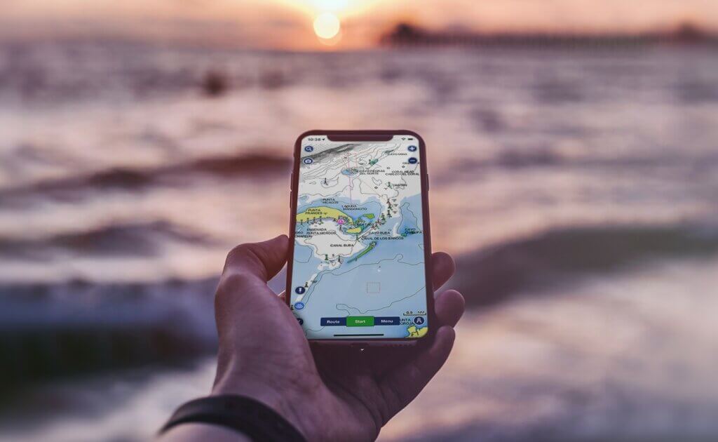
Understanding Nautical Charts
To effectively use GPS for marine navigation, it is essential to understand nautical charts. Nautical charts provide detailed information about water depths, navigational aids, hazards, and other important features of the water bodies. They are essential tools for safe navigation and can be used in conjunction with GPS devices to enhance your understanding of the marine environment.
Nautical charts typically include symbols and markings that represent various features such as buoys, beacons, channels, and underwater structures. By familiarizing yourself with these symbols, you can easily interpret the information provided on the chart. GPS devices can overlay your position on the nautical chart, giving you a visual representation of your location in relation to the surrounding features.
When using GPS in conjunction with nautical charts, it’s important to regularly update your charts to ensure you have the most accurate and up-to-date information. Many GPS devices allow you to download and install chart updates directly from the manufacturer’s website. By doing so, you can stay informed about changes in the waterways and navigate with confidence.
Utilizing GPS Features for Fishing or Sailing
GPS devices offer a range of features that can be particularly useful for fishing or sailing enthusiasts. These features can help you optimize your time on the water and increase your chances of success.
For fishing, GPS devices often include features such as fishfinder integration, which allows you to view underwater structures, contours, and even locate schools of fish. By understanding the underwater landscape, you can identify potential fishing spots and increase your chances of catching that trophy fish. Some GPS devices even offer the ability to mark fishing spots and record your catch data for future reference.
Sailors can also benefit from GPS features specifically designed for their needs. For example, some GPS devices offer sail-assist features that provide information on wind speed, direction, and even laylines. This information can help sailors optimize their sail trim, plan their tacks, and navigate more efficiently. GPS devices can also provide alerts for potential hazards, such as shallow areas or restricted zones, ensuring a safe and enjoyable sailing experience.
Troubleshooting GPS Issues on a Boat
When out on the open water, a reliable GPS system is essential for safe and accurate navigation. However, like any technology, GPS devices can encounter issues that may disrupt their performance. In this section, we will explore some common troubleshooting techniques for addressing GPS issues on a boat.
Poor Signal Reception
One of the most frustrating problems that boat owners may encounter with their GPS system is poor signal reception. This can result in inaccurate positioning data and make it difficult to navigate effectively. To address this issue, consider the following steps:
- Check for Obstructions: Ensure that there are no physical obstructions blocking the GPS antenna’s line of sight to the satellites. Trees, buildings, or even certain metal structures on the boat can interfere with the signal. Adjust the position of the GPS antenna to maximize its exposure to the sky.
- Update Firmware: GPS manufacturers often release firmware updates that can improve signal reception. Check the manufacturer’s website or contact their customer support to see if there are any available updates for your specific GPS model. Updating the firmware can enhance the device’s performance and address signal reception issues.
- Use External Antenna: If poor signal reception persists, consider using an external GPS antenna. These antennas can be mounted on an elevated point on the boat, such as the mast, to improve signal reception. Ensure that the antenna is compatible with your GPS system and follow the manufacturer’s instructions for installation.
- Consider Signal Amplifiers: In areas with weak GPS signal coverage, signal amplifiers can be used to boost the signal strength. These amplifiers are designed to enhance the GPS signal, allowing for more accurate positioning data. However, it is important to note that signal amplifiers may require additional power and may not be suitable for all GPS systems.
Incorrect Positioning Data
Another common issue that boat owners may face is incorrect positioning data displayed by their GPS system. This can lead to navigational errors and potential safety hazards. To troubleshoot this problem, try the following steps:
- Check GPS Settings: Ensure that the GPS system is set to the correct positioning format. Different regions may use different positioning formats, such as latitude and longitude or UTM coordinates. Verify that the GPS settings match the appropriate format for your location.
- Calibrate the GPS: Some GPS systems offer calibration options to improve accuracy. Follow the manufacturer’s instructions to calibrate the GPS device properly. This process typically involves selecting known locations or landmarks and adjusting the GPS settings accordingly.
- Perform a Soft Reset: If the GPS system continues to display incorrect positioning data, try performing a soft reset. This can often resolve temporary glitches or software issues. Refer to the manufacturer’s instructions for the specific steps to perform a soft reset on your GPS device.
- Check for Interference: Certain electronic devices or wiring on the boat can interfere with the GPS signal, leading to incorrect positioning data. Keep other electronic devices, such as radios or fish finders, away from the GPS system. Additionally, inspect the wiring to ensure there are no loose connections or damaged cables that could cause interference.
Software or Firmware Updates
Software and firmware updates are crucial for maintaining the optimal performance of your GPS system. These updates often include bug fixes, performance enhancements, and new features. To ensure that your GPS system is up to date, consider the following:
- Check for Updates: Regularly check the manufacturer’s website or contact their customer support to see if there are any available software or firmware updates for your GPS model. Updates may be available for download or may require a visit to an authorized service center.
- Follow Installation Instructions: When installing software or firmware updates, carefully follow the manufacturer’s instructions. Improper installation can cause issues with the GPS system and potentially void the warranty. Make sure to back up any important data before updating the system.
- Stay Informed: Consider subscribing to the manufacturer’s newsletter or joining online forums or communities dedicated to boating and GPS systems. These resources can provide valuable information on software updates, known issues, and tips for optimizing the performance of your GPS device.
By following these troubleshooting techniques, you can address common GPS issues that may arise while boating. Remember to always consult the manufacturer’s instructions and seek professional assistance if necessary. With a reliable GPS system, you can navigate with confidence and enjoy your time on the water safely.
Maintaining and Caring for a Boat GPS
Having a boat GPS is essential for safe and accurate navigation on the water. To ensure that your GPS system continues to perform at its best, it’s important to properly maintain and care for it. In this section, we will discuss three key aspects of maintaining and caring for a boat GPS: cleaning and protecting the screen, proper storage and battery maintenance, and regular software and chart updates.
Cleaning and Protecting the Screen
The screen of your boat GPS is one of its most important components. It provides you with crucial information about your location, route, and other navigational data. To keep the screen in optimal condition, follow these tips for cleaning and protecting it:
- Use a soft, lint-free cloth or screen cleaning wipes specifically designed for electronics to gently wipe the screen. Avoid using harsh chemicals or abrasive materials, as they can damage the screen.
- If the screen has smudges or fingerprints, dampen the cloth with a small amount of water or a mild screen cleaning solution. Be sure to wring out any excess liquid before cleaning to prevent moisture from entering the device.
- Avoid pressing too hard on the screen while cleaning, as it can cause damage or affect its touch sensitivity.
- When not in use, consider using a screen protector to prevent scratches or other damage. There are various screen protectors available that are specifically designed for marine environments and can withstand exposure to water, sunlight, and salt air.
Taking these simple steps to clean and protect the screen of your boat GPS will ensure that it remains clear and easy to read, providing you with the information you need for a safe and successful boating experience.
Proper Storage and Battery Maintenance
Proper storage and battery maintenance are vital for prolonging the lifespan of your boat GPS and ensuring it functions optimally when you need it. Here are some important considerations to keep in mind:
- When not in use, store your boat GPS in a dry and secure location. Moisture can damage the internal components of the device, so it’s important to protect it from water exposure.
- If your boat GPS is removable, consider removing it from the boat when not in use. This will not only protect it from potential theft but also prevent prolonged exposure to extreme temperatures, which can negatively impact its performance.
- If your boat GPS is installed permanently, make sure it is securely mounted and protected from the elements. Many GPS systems come with waterproof and shockproof features, but it’s still important to ensure that the installation is done correctly to prevent any damage.
- Battery maintenance is crucial for ensuring that your boat GPS remains powered up when you need it most. Follow the manufacturer’s instructions for charging and maintaining the battery. Avoid overcharging or completely draining the battery, as this can shorten its lifespan. Additionally, periodically check the battery terminals for any signs of corrosion and clean them if necessary.
By properly storing and maintaining the battery of your boat GPS, you can ensure that it is always ready to provide you with accurate navigational information whenever you’re out on the water.
Regular Software and Chart Updates
To keep your boat GPS up to date and functioning optimally, it’s important to regularly update its software and charts. Here’s why this is crucial:
- Software updates: GPS manufacturers often release software updates to fix bugs, improve performance, and add new features. These updates may also include important security patches. By regularly updating the software of your boat GPS, you can ensure that it continues to operate efficiently and take advantage of the latest advancements.
- Chart updates: Nautical charts provide detailed information about water depths, navigation aids, and potential hazards. As water conditions can change over time, it’s important to keep your charts up to date. Many GPS systems allow you to download and install chart updates, either through a computer or directly via the device itself. Regularly updating your charts will help you navigate with confidence and avoid any potential dangers.
To ensure that you don’t miss any software or chart updates, consider signing up for notifications from the GPS manufacturer or checking their website periodically. Some manufacturers may offer subscription services that provide regular updates for a specific period of time.
By regularly updating the software and charts of your boat GPS, you can ensure that it remains accurate, reliable, and equipped with the latest features and information for your boating adventures.
In conclusion, maintaining and caring for your boat GPS is essential for its optimal performance and longevity. By following the tips mentioned in this section, including cleaning and protecting the screen, proper storage and battery maintenance, and regular software and chart updates, you can ensure that your GPS system continues to provide you with accurate navigation and peace of mind on the water. Remember, a well-maintained GPS is a reliable companion for your boating journeys.